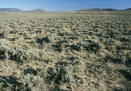
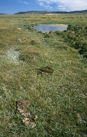
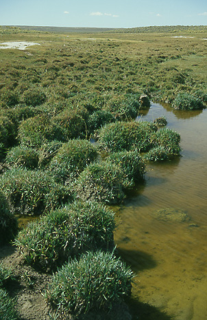
Green Mountain Common Allotment, Wyoming. Photo by Mike Hudak.
Drought here began in 2000 when annual precipitation in nearby Jeffrey City failed to reach 9". On November 30th of that year Jack Kelly, manager of the BLM’s Lander Field Office, wrote a letter to permittees and interested public stating that continued drought in 2001 would likely cause delayed turnout, shortened grazing seasons, reduced stocking levels and possibly no grazing in areas hardest hit in year 2000.

From January through July of 2001 total precipitation for Jeffrey City stood at 3.51", 55% of the long-term average. True to its word of the previous year, the BLM delayed turnout of cattle by four to six weeks—until around June 7th and then mandated their early removal.


Riparian area, Green Mountain Common Allotment, Wyoming. Photo by Mike Hudak. As the drought worsened in 2001 cattle searching for more forage soon invaded a region of the allotment that was not supposed to be grazed until mid-August. An inspection of the area by BLM on July 25th revealed that stubble height in these riparian areas was well below the 4" standard that was supposed to exist at the end of the grazing season NOT AT THE BEGINNING! Notice was mailed by the BLM to ranchers on August 4th that they needed to remove their cattle by August 22nd. Delays pushed the removal date back to August 31st.

West Crooks Creek seen here is one of the riparian areas hard hit by trespass cattle.

Photo at UTM coordinates 0263888/4689569.


Hummocks formed by cattle trampling of riparian area. West Crooks Creek, Green Mountain Common Allotment, Wyoming. Photo by Mike Hudak. Cattle trampling in wetlands facilitate erosion which leads to formation of hummocks as seen here at West Crooks Creek. In a latter stage of decline, when all the humic material has eroded, only dried, white hummocks will remain. This will indicate that the wetland has changed from one capable of storing water for long periods to one capable of merely slowing the movement of individual precipitation events for a short time.

As a wetland’s ability to hold water declines so to does its production of sedges and grasses. And as cover declines so to does sage grouse production as birds become increasingly vulnerable to predators.

Photo at UTM coordinates 0263888/4689569.


Text and Photos © 2004– by Mike Hudak, All Rights Reserved